In continuing my quest to become a winter 46er I drove up to the Adirondack Loj this past Tuesday to meet with a couple of hiking partners (Jonathan and Marie) that I met through the ADK High Peaks Foundation. We had the same goal in mind; to conquer Haystack, Marcy, Skylight, and Gray in the same day.
The forecast was calling for overcast skies and occasional rain showers and I was a little hesitate about packing my heavy DSLR on such a long day, especially when the chances for views was slim. Before I left home I had a small point-and-shoot already packed in my bag and decided to bring the DSLR just in case.
On my way to the Loj the moon was peaking in and out of the clouds and I could see some stars in the sky. Perhaps the forecasters were wrong. In the end I couldn’t bear to leave my camera behind and potentially miss a great photo-op so I decided to swap out the wimpy point-and-shoot and put the DSLR in its place. If nothing more it would serve as resistance training.
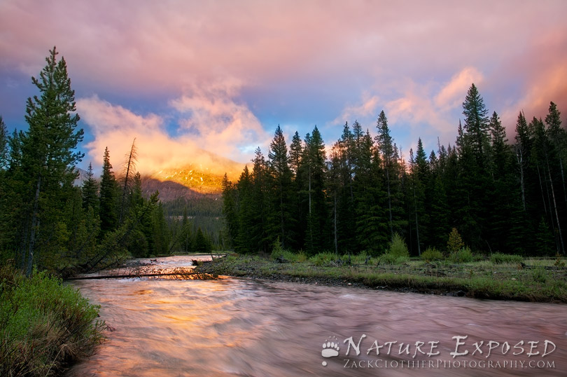
We hit the trail at 7am in microspikes with the beautiful colors of sunrise keeping us company until we reached the crossing at Marcy Brook. Luckily for us there was a thin but supportive shelf of ice covering much of the brook so the crossing was not a problem.
We took a small break at Marcy Dam and my two hiking companions changed into lighter clothes. As I waited I noticed that the wonderful magentas that graced the sky not ten minutes before had been replaced by dull gray clouds in every direction. A light drizzle was soon to follow. We put on our shells and once again set off towards our destination.
The rain showers didn’t last long and a little further up the trail we made the crossing at Phelps Brook without incident. The Van Hoevenberg trail still had plenty of snow and stepping off of it had its consequences but we continued in microspikes. We kept a steady pace on the climb to Indian Falls and crossed here without a problem as well.
By the time we reached the junction with Bushnell Falls it started to rain again, but this time it was more than just a drizzle. We decided to switch to snowshoes since we were postholing quite a bit due to the rising temps and rain softening the snow. The wind was blowing the rain in our faces as we approached the junction with the Phelps trail. We quickly dashed down the trail to get to the cover of some trees.
On the way down I sprung a different kind of spruce trap. A large spruce tree was bent over across the trail and just as I pressed down on it to step over it sprung up out of the snow and just grazed my face as it went by. I was waiting for the rope to catch my foot and leave me dangling in mid-air by my ankle but it didn’t happen.
At the Slant Rock junction we took a short breather and had a bite to eat before dropping our packs and tackling the steep pitches to Little Haystack. By now the visibility was severely reduced and the wind was screaming. The ice was almost completely melted and there was only a couple of tricky spots going up. As we neared the summit of Little Haystack the wind was blowing the rain (or ice pellets?) right into our faces. It felt like tiny pin pricks all over my exposed face. It was at this time that I wished that I had taken my goggles out of my pack before dropping it. The wind wasn’t brutally cold as it usually is in winter, and some of the gusts actually felt warm. It was the rain combined with the wind that made it so unpleasant.
On the backside of Little Haystack we encountered more patches of ice that made for some careful maneuvering to get down. The wind (which we guessed was easily gusting to 60mph) was making it even harder to get a grip on the icy patches. Finally we reached the col where we sprung some spruce traps before reaching the large slabs of rock below Haystack’s summit. We decided to stash our snowshoes here for the final ascent.
The climb from here was more mixed rock and ice, with some deep snowy sections here and there. We regretted not bringing the microspikes from our packs. The visibility was still very poor as we picked our way up towards the summit. The winds, while still brutally fierce, seemed less intense than those we experienced on Little Haystack. Perhaps I was just getting used to them. We reached the summit and high-fived each other before snapping a quick picture, and then scurried back down as fast as we could safely go.
Shortly after leaving the summit the wind knocked my hood off and took my baseball cap right off my head. I watched as it disappeared into the snowy abyss. Walking across the icy sections was very difficult and at one point the wind actually blew me across the ice and almost took me off my feet near a drop-off. Marie and Jonathan were only about 25 feet in front of me and all I could make out was their silhouettes in the fog.
Back in the col we picked up our snowshoes and decided to bareboot up Little Haystack. As soon as we reached the top of the rock the wind was there to greet us in the worst way. Again there were more traction issues as we made our way across the top before finally dipping down in the trees and out of the winds.
We made good time from the Basin/Saddleback junction with a fun butt-slide on the steepest section before the junction with Bushnell Falls. We stopped again for a break and Jonathan gave me a piece of paracord to use as a shoelace since one of mine got shredded somewhere on Haystack.
It was now a little past 1pm and we still had a long ways to go so we picked up and slowly traipsed up the trail towards the Phelps junction. On the way up the weather took a turn for the better and soon views opened up all around us. Even Haystack was out of the clouds. We joked about going back to the summit for a view. Just before we reached the junction there were some loud voices echoing through the trees. It was 3 skiers just getting ready to ski down on the Van Hoevenberg trail. Ahead of them there were no fresh tracks. We would be the first ones up Marcy that day.
The wind was still blowing but the sun was shining now and it was quite warm out. It was definitely a morale booster. Watching the clouds move over Marcy was like watching a movie being played in fast forward. I took my camera out here for the first time and snapped a few shots as we all soaked up the moment for a few minutes before moving on.
The weather changed constantly during our ascent, blue skies one minute to dark clouds the next, but when we reached the summit there were excellent views in every direction. We exchanged more high-fives and a snapped a few pictures before heading towards Skylight. The south face of Marcy was a drastic change from the nice snow fields on the northern slopes. There was exposed rock and fragile alpine grasses all around us, and lots of water running down it. Still wearing snowshoes me and Marie stayed on what little ice and snow was left while Jonathan followed the cairns just to our left.
The descent down to the Four Corners went quick as the snow was soft and made for easy glides. Occasionally someone would posthole even with the snowshoes on. Upon reaching the Four Corners we again dropped our packs and made the 0.5 mile push to the summit of Skylight. On the way up we may have set some sort of spruce trap record, falling in to many times to count. At one point Jonathan was up to his neck in the snow. It was very tiring and a little frustrating at times but we pressed on.
It had been a while since I was last up there but I remembered the trail was a fairly straight shot to the summit. This “trail” we were following was zigzagging all over the place. Somehow we had gotten off trail and were wandering aimlessly through spruce trap heaven. I pulled out my GPS which had a previous track on it from the last time I did Skylight. According to the track we were off to the right of the trail. We headed in that direction and soon came across the actual trail and it was an easy walk from here to the summit. We hung around long enough for a few pictures and headed back down, following the trail this time.
Back at the Four Corners we fueled up and headed towards Lake Tear. By now it was around 4:30 and with the sun not setting until 7 we knew we’d have plenty of daylight left to make the summit of Gray. The herdpath wasn’t difficult to find as there were some faint tracks at the beginning of the path and they became easier to follow until we got about midway up where they just vanished. We scouted a couple of spots and finally located the path again. A little further up we skirted around a small waterfall and not long after we were on the summit enjoying the sunshine and warm temperatures once again. We walked across the summit ridge and located the marker and then congratulated each other on an awesome achievement. Another summit shot and we were on our way.
The descent down to Lake Tear was pretty uneventful. We stopped once to block off our dead-end paths with sticks so others would not get confused. Earlier that day we decided our return would be via Lake Arnold so after changing my socks at Lake Tear we were off. The Feldspar trail was nice and packed and it was fast going down to the junction. The first crossing was at Feldspar Brook. The water here wasn’t to deep and we crossed it without a hitch.
At the next crossing, however, we weren’t so lucky. This time it was on the Opalescent River and it was quite sketchy indeed. The ice underneath the water was very soft and sponge-like and the water was about 6 or 7 inches deep and flowing pretty fast. It was probably a good 6 feet across to the other side.
Jonathan went first and leaped across using his poles to anchor himself with and only managed to put one foot in. After he was safely across he picked up a large rock and tried making us a stepping point with it but the rock sunk below the water and into the ice. He threw another rock in and I was able to pull it out and reposition it above the water. I was the second one to go across. I carefully stepped out onto the rock but just as I went to jump off of it the rock sunk deeper and I almost ended up in the water. Jonathan grabbed my arm and pulled me up the bank. I thanked him and began searching around for more things to make a bridge with so Marie could get across. I snapped a couple of sections off an old downed tree and tried making another stepping point but it wasn’t very sturdy. Marie jumped onto the log and it gave way but we caught her and pulled her to the other side just in time.
A little further down the trail we had to cross the Opalescent again. This time it wasn’t as bad though, as the ice underneath the water was just strong enough to hold some weight. There was one other crossing near the swampy section but there were two logs still above the water and this made it really easy.
Our pace had slowed considerably as we made our way steadily up towards Lake Arnold. The bounce in our step from earlier in the day was no more. I could feel a small amount of water sloshing around in my right boot but didn’t feel like stopping to take it off so I kept moving. Eventually my sock absorbed most of the water and the sloshing went away. By the time we reached Lake Arnold the darkness was closing in and we took our headlamps out shortly thereafter. We were glad to finally see some downhill slopes and began to move faster, munching away on some chocolate for a little extra energy boost.
Back at Marcy Dam we could hear the thunderous roar of the water just below the dam, it sounded much louder than it was that morning. When we reached the crossing we were shocked to see all of the ice that we had used to cross on that morning was gone and the quiet little brook was transformed into a raging torrent!
We searched for another way to cross but to no avail. We considered going out via South Meadows but the added miles plus the road walk back to the Loj wasn’t very appealing either. We took our snowshoes off and put on the garbage bags that we had brought. We then put our microspikes on over the garbage bags for some added traction on the slippery rocks.
After contemplating for a couple of minutes Jonathan decided to go for it. Me and Marie watched from the bank as he fought the strong current. The water was deep and I could see it going above his garbage bags. He used his poles to try to steady himself in the water and finally made it across without falling in.
Marie took a different route and almost fell in while battling the current but Jonathan jumped out and caught her and pulled her to safety. Now it was my turn. My concern was not only making it across safely but also making sure my camera inside my packed stayed dry. Jonathan threw me one of his poles so I’d have two of them to steady myself with. I contemplated for a few minutes before finally stepping down into the deep icy water. My boot instantly filled with water and when I felt that I knew that I had no choice but to go for it. Halfway across I nearly lost my balance and Jonathan rushed out to grab me, falling in doing so. I dropped one of the poles in the water as I spun around to help him up and then managed to catch the pole before it was swept away by the current.
My feet were freezing by the time we reached the other side. We took off the garbage bags and put our microspikes back on and then got moving again as quickly as possible. The icy bath did seem to boost my energy level though and the last two miles went by insanely fast. We reached the trail register at 9:20pm.
We talked about how it would have been smart to park one car at South Meadows and the other at the Loj so we could have had the option if the brook was impassable. How smart this would have been had we thought about it that morning. They say hindsight is 20/20 and it couldn’t be more true. Lesson learned. Next time we’re calling for a copter! 😉
All in all it was an awesome day with some great company!
TRIP STATS:
Total Distance Hiked: 21.4 Miles
Elevation Gained: 7,500ft
Time Elapsed: 14hr. 20min.
Additional Notes: Lots of Teamwork!
THE OUTTAKES
-

-
The Great Cloudsplitter
-

-
Grandeur!
-

-
Giant Mountain from Marcy
-

-
Catching some rays
-

-
Boreas Ponds from Marcy
-

-
Brooding Skies
-

-
Descending Mount Marcy
-

-
View from Mount Marcy’s south face
-

-
Sunbeams from Skylight
-

-
Panther Gorge from Skylight
-

-
Tenacity
-

-
The MacIntyre Range from Gray Peak
-

-
Skylight from Gray Peak


 “Marcy and Colden from Iroquois’s windswept col”

 “Snowshoe Hare tracks below Algonquin’s summit”
 “Dan’s unique find, a spruce tree sculpture!”
 “Krumholtz Line on Algonquin”
 “Cloud whisk over Algonquin”
 “Single cloud over Algonquin”
 “Mount Marcy from windswept col”
 “Another unique spruce tree sculpted by the wind”
 “Iroquois panorama”